
Before choosing a lot or fixing a house plan, decide what you need an assessment to establish. A regional map screen, a local planning record, a survey, a field visit, and an engineered feasibility study answer different questions and carry different costs. A free map result is not equivalent to a site investigation, and a paid report does not guarantee that a home can be built as proposed.
These are different professional services, so one national U.S. or Canadian fee would not describe them all. Fees depend on the property, available records, fieldwork, specialist disciplines, travel, deliverable, and intended design decision. Rather than apply a national average or convert a fee from another market, make each provider price the same site question and report scope.
Start with the house and the decision
Give the assessor a simple description of the intended home, likely building area, access, utilities, occupancy, and the sites or locations under consideration. If the building footprint is still flexible, show a few realistic placements. If you are comparing lots, use the same proposed house on each one. A generic “climate risk report” may not examine the area where a home could actually be placed or answer whether its access, utilities, and drainage can work.
Decide whether you are trying to screen out a site, identify issues for a purchase decision, set a planning allowance, or commission work that can inform design. Those are different deliverables. A screening report may point out further questions. A survey or field investigation may resolve some physical conditions. An engineer’s feasibility opinion may compare specific building placements or mitigation concepts. Request the conclusion you need before comparing fees.
Compare the stages of investigation
Many site decisions use more than one stage. The sequence below is a budgeting framework, not a mandatory checklist; a professional or local authority may recommend a different order for a particular lot.
| Stage | What it can provide | What to include in the price |
|---|---|---|
| Regional or community screening | A first look at broad flood or wildfire exposure and whether a more specific inquiry is sensible. | Tool or report charge, map date and scale, hazard types covered, address or parcel coverage, and known data limits. |
| Local record and authority check | Current local maps, prior studies, floodplain or planning information, wildfire rules, and questions for the authority responsible for a decision. | Records reviewed, agency contacts, follow-up, application or records fees, and a written list of unresolved requirements. |
| Site visit, survey, or measurements | Physical conditions such as elevation, slope, drainage paths, vegetation, access, boundaries, and existing infrastructure. | Field time, surveyor or specialist, travel, equipment, measured area, season, and the accuracy or limits of each deliverable. |
| Specialist investigation | A focused flood, coastal, geotechnical, slope, drainage, or wildfire assessment when the initial evidence leaves a consequential question open. | Discipline, testing or modeling, samples, site access, report assumptions, follow-up, and whether design is included. |
| Feasibility or design comparison | A professional comparison of feasible building locations, prerequisites, mitigation concepts, residual risk, and items that need later design. | Alternatives studied, drawings or calculations, consultations, permitting support, exclusions, and the point where construction design begins. |
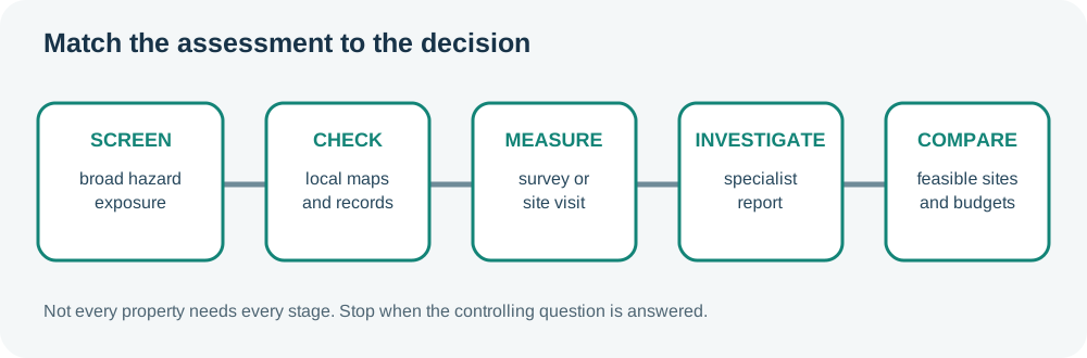
Ask for each stage separately when possible. A records review may be useful even if it concludes that field work is necessary, but it should not be sold as a parcel determination when the data cannot support one. Conversely, do not pay for broad modeling if a current local authority record or a focused site visit will answer the decision.
Treat maps and screening tools as one input
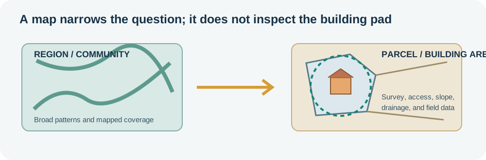
Every map or online tool has a purpose, date, geographic scale, and missing-data risk. A map may show community exposure without describing a particular lot, building pad, drainage path, access road, or slope. Ask which hazards and conditions it includes, whether the parcel boundary and proposed building area were checked, and which authoritative local source should be consulted next.
Public Safety Canada’s April 2026 release described an opt-in rollout for Canada’s Flood Risk Finder and said local coverage would be announced as provinces and territories participated. That release does not establish current coverage for every address. If the tool is offered for a location, treat it as screening that complements local, provincial, and territorial mapping; confirm live coverage and current local records before relying on it. A missing result or a low screening rating is not proof that a site is free from flood exposure.
National housing or climate models can help explain why site choice matters, but their scale is different from a homeowner’s purchase decision. The Canadian Climate Institute’s 2025 analysis models housing exposure and potential losses across Canadian development scenarios; its limitations do not let a buyer calculate an individual lot’s expected loss, insurance premium, mitigation cost, or return. Do not divide a national total by the number of homes or use a modeled community result as a property quote.
Make the professional fee comparable
Ask every provider to state what the report will let you decide. A useful scope identifies the parcel and proposed building area, the records and map editions reviewed, field observations or measurements, specialist inputs, assumptions, unresolved conditions, and the next decision that could change the result. It should distinguish information useful for screening from information suitable for design or a permit submission.
Compare fees by deliverable rather than job title. One provider may include a site visit and written alternatives; another may offer a desktop report only. Check whether travel, survey, elevation data, soil or groundwater work, hydrology, modeling, agency calls, meetings, revisions, and construction concepts are included. Ask how the provider will report an inaccessible area or missing record and whether a follow-up visit costs extra.
Authority charges may also sit beside the professional fee. Houston’s 2026 schedule lists $402.84 for a new single-family floodplain development permit. Hamilton Conservation Authority’s 2026 schedule lists $841.40 for a basic minor development permit and $1,549.09 after HST for a minor application requiring technical-study review. These are local application and review charges, not the cost of preparing a survey, flood or geotechnical study, engineering design, or construction. The schedules use different classifications and scopes; confirm the current fee, currency, tax treatment, and applicable authority before using an example in a budget.
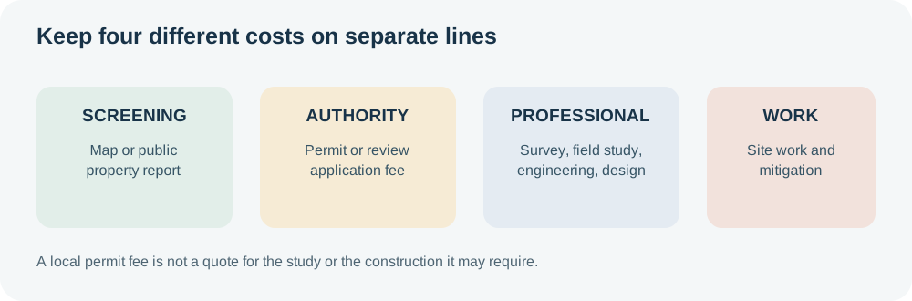
The cost of the assessment itself can be only one part of the due-diligence budget. Include the time to obtain records, survey access, specialist travel, testing, and a second opinion if a consequential issue remains unresolved. Confirm whether the report is limited to flood and wildfire or also evaluates coastal erosion, slope stability, drainage, utilities, access, or other site conditions. Do not assume that a general home inspection covers these specialist questions.
Compare the cost implications of feasible sites
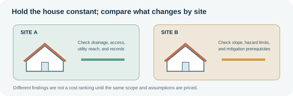
An assessment can inform a construction budget without producing a guaranteed construction quote. For each feasible site or building location, ask the design and construction team to list the same house and show which assumptions change. The comparison may need separate lines for:
- foundation or elevation choices that depend on confirmed site conditions;
- access, grading, drainage, utility extension, and construction logistics;
- flood, coastal, slope, or soil investigation and later design;
- wildfire-related assemblies and near-home work after the local baseline is established;
- permits, review, inspection, documentation, and required professional services;
- contingencies for conditions that the early assessment could not resolve.
Keep a site investigation fee separate from a mitigation allowance, and keep both separate from the home’s ordinary construction price. If a report describes an enabling measure but not a design or bid, carry it as an unresolved scope item rather than assigning it an invented amount. If actual quotes are not yet possible, use comparable allowances with the same assumptions and state what could change them.
For example, one lot may appear straightforward on a regional map but require a survey or drainage study before the building area is clear. Another may have a documented constraint that prompts an early redesign or a different placement. Neither outcome proves which site is cheaper until the same home, site work, professional fees, utilities, and residual-risk assumptions are compared. The report’s value is often that it reveals which unknowns need a price before commitment.
Use a decision summary before signing
Before paying for a later design phase or making a site commitment, request a short written summary that answers:
- What source, map, date, and hazard area were checked?
- Which parts of the parcel and proposed building area were visited or measured?
- What is known, what is uncertain, and what further work is recommended?
- Which local authority or professional must confirm buildability, code, permit, or design conditions?
- What findings could change the house location, foundation, access, site work, or mitigation budget?
- What is excluded from the report, and what would the next assessment stage cost?
- Which residual risks remain even if the proposed design is followed?
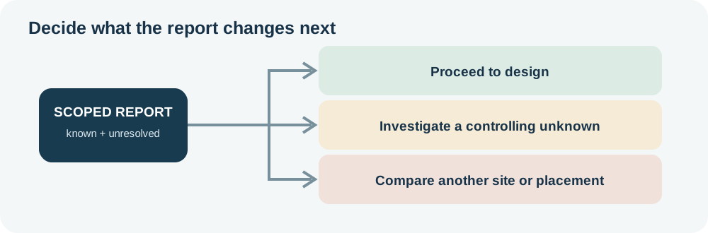
Set a decision boundary with the professional: proceed to design, obtain more information, compare another location, or stop spending until a controlling uncertainty is resolved. A report should not promise a safe property, an approval, or a certain future loss. Ask how current conditions or a later design change would affect its conclusions.
Keep the site decision distinct from the build package
This guide addresses preconstruction flood-and-wildfire investigation for a site or building location. Home Climate Resilience Assessment Cost concerns an existing home and its retrofit priorities. Wildfire-Resistant New Home Construction Cost compares selected wildfire-related construction assemblies after a site and baseline have been defined. Flood retrofits, shoreline work, and slope assessment have their own feasibility questions and are not included in a generic site fee.
The useful result is a scoped report that narrows uncertainty enough to make the next decision. Maps, national models, surveys, and engineered assessments can each contribute, but none should be priced or interpreted as a guarantee that a specific lot is safe, buildable, insurable, or less expensive.